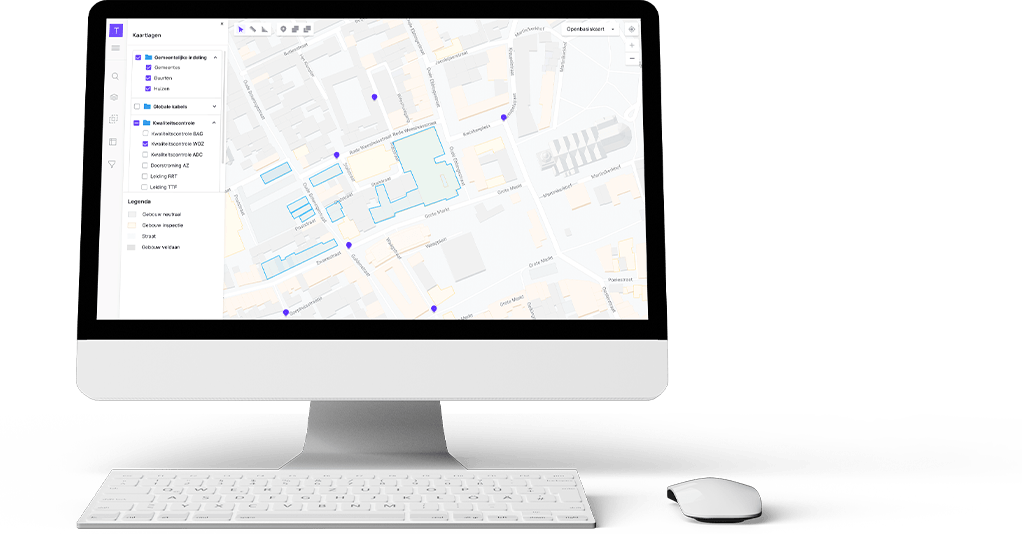
Why a GIS viewer?
A GIS, or Geographic Information System, shows information on a digital map, offering you the needed insights in a location. The information could contain the exact location of houses, the presence of underground cables, or the fact that there are some public functions located in the area. Combining these seemingly uncorrelated data provides you with valuable information and new insights.
Your digital map helps others
Your Tailormap GIS-viewer allows you to publish large amounts of relevant spatial data. Combined, this offers easy access to valuable information for colleagues, clients and yourself, to be used in decision making.
Possibilities
How can Tailormap help you in answering your questions? There is no way an exhaustive list could ever exist for that. However, you could think of:
- How many houses are threatened by flooding in a certain area?
- Are childcare facilities in locations affected by pollution?
- Where to find new locations for wind turbines, solar farms, or electricity networks?
- Where in the city can companies obtain a permit for hazardous industrial activities?
- How does the age distribution in neighborhoods compare to the location of AED’s?
If you want to know more about the possibilities for your organisation, we’d love to help. Contact us to discuss the possibilities.

Open Source inside
Tailormap is developed by B3Partners, a Dutch company fully focussed on GIS software solutions for use in government and business. In twenty years we have build a reputation in open standards and open source. We build on the OSGeo stack, and contribute to OSGeo projects as well. Sharing our expertise and the components we build are part of our mission. For our customers, this offers benefits such as reusable products, no vendor lock-in, and cost reduction.
B3Partners is designer and developer of some comprehensive open source projects, with Tailormap as the flagship product. These projects, among some smaller tools, can be found on Github. Of course we also contribute to other OSGeo projects, like Geotools and GeoServer.
Support
Tailormap offers additional options such as:
- Professional support and helpdesk
- Tailormap is available as SaaS
- Available in English and Dutch. Other languages can be added on demand.
- Uses national and international coordinate reference systems
- Easy setup using predefined configurations
Questions about the technical possibilities and specifications of the van Tailormap can be asked by telephone or email.