Who we are
B3Partners is a Dutch open source GIS company, based in Utrecht. We develop, host and support GIS software, completely open source. En we enjoy helping users of our software on their geospatial journey.
Our mission: GIS for everyone
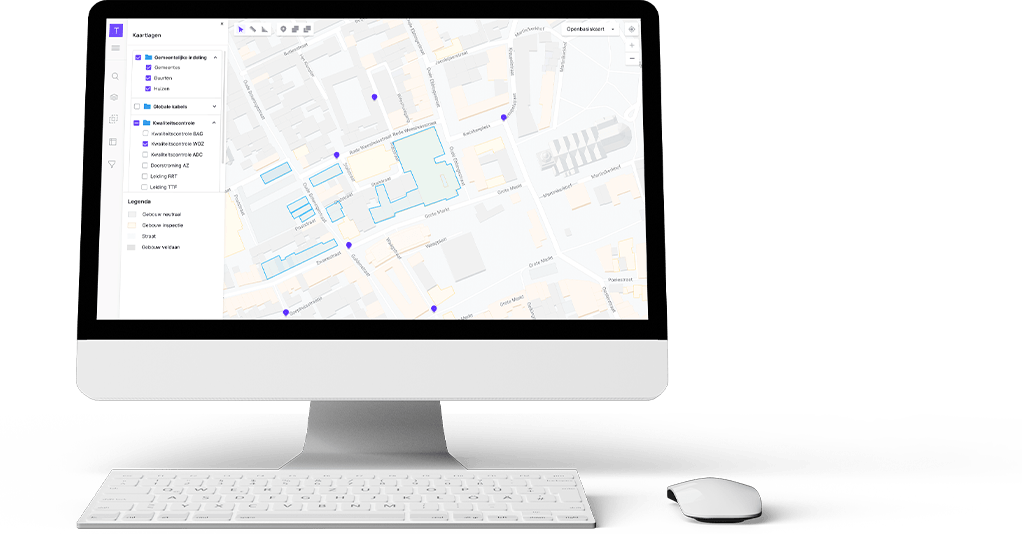
We build the geospatial tools anyone can use. Working with geospatial data nowadays implies two things: sharing your data with others, and using data shared by others. Our software is build especially for those purposes.
We are of the opinion that sharing will add value for all involved. Sharing of information, sharing of tools. That is why our products are distributed as open source software. We use open components in our stack, add new open components to the stack, and invite others to do the same.
We plot our own course in developing software. We observe what is happening around us, know our field of play, and what direction we would like to move in to, and use that to enhance our geospatial software.
Do you have specific questions on how to use Tailormap for your spatial needs?
Contact us for more information.
Common Ground and Open Source
B3Partners has been applying the principles of Common Ground for years when developing GIS solutions. This fits in well with our belief in Open Source; sharing the solutions found with other developers. Open Source and Common Ground contribute enormously to flexibility, agility and sustainability in our work for clients. Moreover, it prevents unnecessary costs.
Support
Tailormap offers additional options such as:
- Professional support and helpdesk
- Tailormap is available as SaaS
- Available in English and Dutch. Other languages can be added on demand.
- Uses national and international coordinate reference systems
- Easy setup using predefined configurations
Questions about the technical possibilities and specifications of the van Tailormap can be asked by telephone or email.